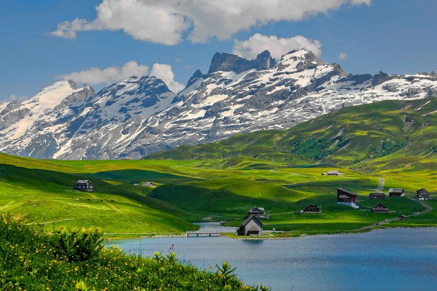
Switzerland is famous for its pristine Alpine vistas, precision engineering, and a penchant for turning the impossible into reality. This week, a team of digital artisans and engineers unveiled something that feels like a love letter to the country’s meticulous reputation: a full‑scale, block‑by‑block recreation of the Swiss Confederation, rendered at a literal 1:1 scale. The project, hosted on the Manifold 3D platform, isn’t just a novelty; it’s a proof‑of‑concept that could reshape how we think about geographic data, urban planning, and even heritage preservation.
Background / What Led to This
The idea of modelling entire nations in miniature isn’t new. From Lego maps in classrooms to large‑scale topographic models used by the military, physical representations have long helped people visualise complex terrain. What makes the Swiss project different is the convergence of three technological trends: high‑resolution LiDAR scanning, cloud‑based point‑cloud processing, and the rise of modular, parametric block systems that can be rendered and printed on demand. Over the past decade, Swiss cantons have invested heavily in open geospatial data, making it one of the most accurately mapped countries in the world. When Manifold 3D’s engineers stumbled upon a publicly available 0.5‑meter resolution digital elevation model (DEM) of the entire nation, they realised they could push the data into a new domain – a one‑to‑one, block‑based digital twin.
What Exactly Happened
Using Manifold 3D’s proprietary “Block Builder” engine, the team converted the national DEM into a lattice of 1‑meter cubes, each tagged with precise geolocation metadata. The result is a virtual terrain that you could walk through in a VR headset, or slice into a physical model using CNC‑cut foam blocks. The website https://blocks.manifold3d.ch/ showcases an interactive viewer where users can zoom from the Swiss Alps down to a single chalet, all while the underlying geometry remains true to the original survey data. In practical terms, the model contains roughly 8.5 billion individual blocks – enough to fill a small warehouse if printed in concrete. The developers chose a block size that balances visual fidelity with computational feasibility, allowing the model to be streamed over ordinary broadband without choking browsers.
Industry Impact
For the geospatial industry, the Swiss block model is a watershed moment. First, it proves that nation‑scale datasets can be broken down into modular components that retain positional accuracy, opening doors for real‑time simulation of climate scenarios, disaster response, and infrastructure stress testing. Second, the block‑based approach dovetails neatly with the growing “digital twin” ecosystem, where physical assets are mirrored in a virtual environment for monitoring and optimization. Companies like Siemens and Autodesk have already hinted at integrating block‑level detail into their BIM pipelines; the Swiss example offers a ready‑made template. Finally, the project showcases the commercial viability of on‑demand, large‑scale 3D printing. Imagine a future where city planners order a 1:1 block replica of a new subway line, or museums commission a tactile map of historic battlefields for visually impaired visitors.
What This Means for You
If you’re a tech‑savvy professional, the Swiss block model is a signal that high‑resolution spatial data is becoming more accessible and manipulable than ever before. Architects can now experiment with site‑specific topography without waiting weeks for a surveyor’s report; educators can bring an entire country into the classroom for interactive geography lessons; hobbyists can download a slice of the Alps and 3‑print a piece of the mountain range for personal projects. Moreover, the model’s open‑source licensing encourages community contributions – you could add layers of demographic data, transport networks, or even real‑time weather overlays, turning a static map into a living, breathing platform.
What to Expect Next
Manifold 3D isn’t stopping at a single country. The development roadmap mentions expanding the block engine to cover the entire European continent by 2025, with a focus on modular updates that reflect political boundary changes, new construction, and environmental shifts. Parallel to that, the team is piloting a “Hybrid Block” system that blends physical 3D‑printed blocks with augmented‑reality overlays, allowing users to point a tablet at a printed block and see real‑time data streams like traffic density or air quality. In the longer term, the technology could feed directly into autonomous vehicle navigation stacks, providing centimeter‑level terrain awareness that GPS alone cannot deliver.
Frequently Asked Questions
How accurate is the block model?
The underlying DEM has a vertical accuracy of ±0.2 meters and a horizontal resolution of 0.5 meters, which translates to each 1‑meter block representing a real‑world cubic meter with less than 5% error margin. The model inherits the same accuracy, and any additional data layers (e.g., building footprints) are snapped to the block grid to maintain consistency.
Can I download the model for personal use?
Yes. Manifold 3D offers a tiered licensing scheme: a free tier that allows download of a single canton at 1:10,000 scale, and a paid “Full‑Scale” tier that grants zip‑file access to the entire nation’s block dataset. All downloads are provided in standard OBJ and glTF formats for compatibility with most 3D software.
Is the technology applicable outside of geography?
Absolutely. The block‑based decomposition algorithm can be applied to any large‑scale volumetric dataset – from medical imaging (think voxel‑level organ models) to industrial design (complex machinery broken into printable modules). The Swiss case simply illustrates the concept on a familiar, high‑profile canvas.
Conclusion
The Swiss block‑by‑block model is more than a digital curiosity; it is a tangible demonstration of how precision mapping, cloud processing, and modular 3D construction can converge to create tools that are both scientifically rigorous and creatively inspiring. Whether you’re a planner, a teacher, a maker, or just a tech enthusiast, the ability to explore an entire country at a 1:1 scale – virtually or physically – opens a new frontier for analysis, storytelling, and problem‑solving. As the technology matures and scales globally, we can expect a future where every city, mountain, and river is just a block away from being fully understood and re‑imagined.
Photo by Ricardo Gomez Angel on Unsplash